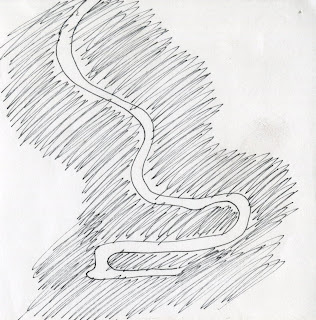
.jpg) Rivers naturally take the steeper slope as their path towards open water.
Rivers naturally take the steeper slope as their path towards open water..jpg) "...at night it looked like a glow-worm."
"...at night it looked like a glow-worm." The difference between Achafalaya and Mississippi elevation averages thirty feet.
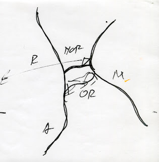
 Old River, Red River, Achafalaya River, and the Mississippi form an 'H'
.jpg) Old River Locks- eleven gates able to adjust water flow amount into Achafalaya
Old River Locks- eleven gates able to adjust water flow amount into Achafalaya.jpg) Old River construction took place north of Old River
Old River construction took place north of Old River Rapids at the Old River Locks are as viscous as Grand Canyon rapids, but 5 times as wide
 Complaints made to the Corp of Engineers by farmers and citizens alike
.jpg) Minor floods occasionally / grand floods often
Minor floods occasionally / grand floods often Tree Pruning analogy directed towards Mississippi/Old River blockade
Heavier sediment falls closer to the banks, while lighter sediment flows back into marsh, forming natural levees
'H' beams are the real structure of the Old River Lock
 Delta slipping off the shelf as a block of butter
.jpg) Boats can be seen floating above New Orleans
Boats can be seen floating above New Orleans.jpg) New Orleans is 15 feet below sea level, and sinking
New Orleans is 15 feet below sea level, and sinking The first natural break in the Mississippi is 60 miles south of New Orleans
 Forces of the river have dugout both sides of Old River Locks
 Morgan City affected by levees and diversions
 Erosion Study
Erosion Study-Relation between scales
 Erosion Study-Relation between roots and rivers
Erosion Study-The relationship between scales, large and small, roots and rivers, creates an intricate scheme connecting the largest watershed to the smallest root system
 Dichotomy-Poetic and tectonic melding universally, resulting a man-controlled drawing presenting feelings of a natural, wild image
 .jpg)


No comments:
Post a Comment